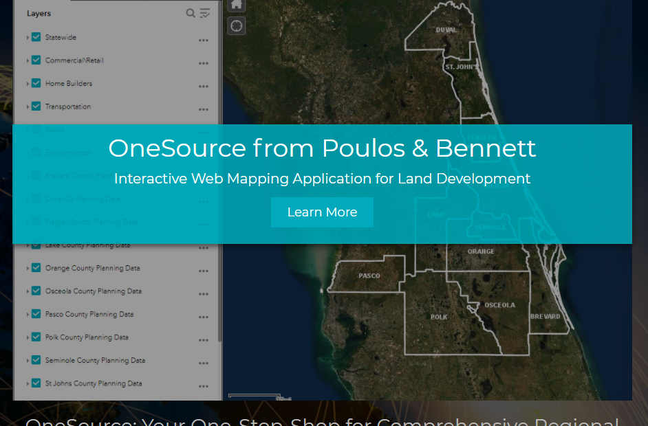
As we ring in the new year, we are pleased to announce that we are launching OneSource, our robust and powerful Web Mapping Application that was designed using our ArcGIS Enterprise System in alliance with our ESRI Business Partnership. With well over 200 data layers across 11 counties in Central Florida, OneSource allows our clients the ability to quickly and efficiently access, analyze, and map a plethora of regional planning and engineering data. Designed to help users accomplish tasks such as due-diligence research, site suitability analysis, and other detailed property research and mapping. Users can query layers for filtered results, make custom selections, export customizable PDF maps, Excel tables, and other results directly from the application, saving time and money by cutting back on the need for intense web browsing and data downloading, or advanced GIS software, in order to make informed and reliable decisions. Accessible on desktop computers, mobile devices, and tablets, OneSource is designed for ease of use in the office or out in the field.
Contact our GIS Manager, Travis Hill, at thill@poulosandbennett.com today to see how you can leverage OneSource for your business.